
A PROW is a Public Right of Way. Also Referred to as just ROW
Each County has a labelling system to identify its footpaths.
There are formal maps available in LCC showing all the paths,
and identifying them with the LCC identity.
These are also found when working Mario (an LCC Mapping system).
Counties have their own labelling systems so you need to know what
identities to use when reporting an issue.
You can also find the identity more easily through the link below.
When it opens you need to enter a location, e.g. preston, chorley...........
- It then gives an option of what type of map to use. OS is suggested.
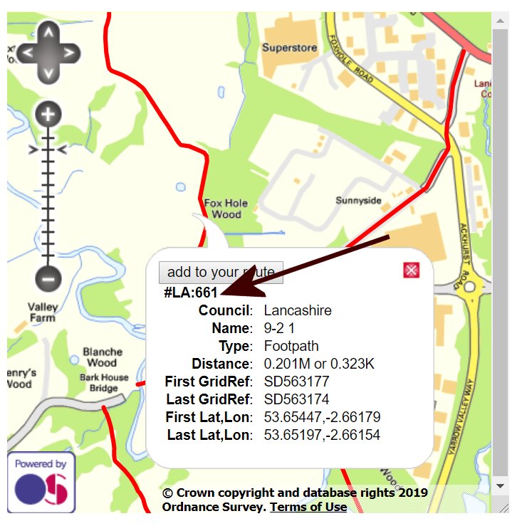
- It then opens with explanatory text and a map of the area requested.
- The map can be moved about and red lines indicate footpaths.
- If you click on a footpath, it's identifying information is shown.
The ROW page can be found HERE